
BergeSeen Trail Stage 10


From Bad Ischl to the Katrinalm (3 hours)
From the tourism office of Bad Ischl (located in the landmarked Trinkhalle building immediately south of the parish church), the trail heads upstream along the Traun River. The route first arrives at the Elisabeth Bridge and then continues along the promenade passing Café Zauner. The trail continues along the Traun past the trotting track to the Traun Bridge. From there, the route veers right to the Rinden Chapel and right again along a narrow path which leads directly to the valley station of the Katrin Cable Car.
Hikers can either use the cable car to reach the Katrinalm or go on foot along the following route: The trail ascends through a meadow to the left of the cable car station. The path goes left above the AV-Kletterhalle (climbing hall) to a fork. Bearing right, the route continues to another junction. The trail heads uphill to the left to a new intersection. From here, hikers can go left and reach the Wildenstein Castle Ruins in a short amount of time.
Our route continues to the right along a flat forest road until reaching a new junction after 400 metres. The trail continues to the left along the so-called ‘Bilderweg’ through the forest until arriving at the ski run. The trail follows the ski run until reaching a forest road. The route ascends moderately steeply to the left along the Windengraben Forest Road. Soon the road curves can be shortened by way of narrow cut-through paths, and the trail finally reaches the end of the forest road.
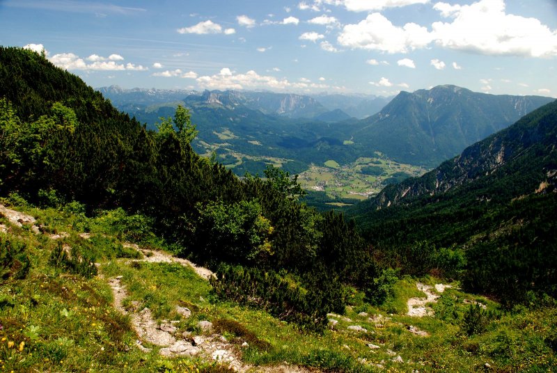
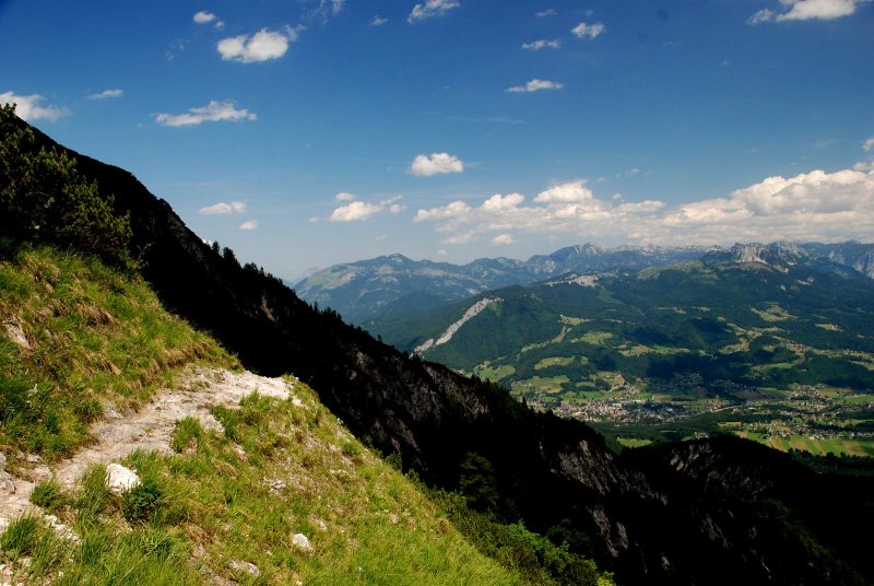
The ascent to the mountain ridge is even steeper, and then along the southern side of the mountain, the terrain flattens as the trail leads to the Katrinalm (alpine meadow). From here, hikers have spectacular views of Lake Hallstatt and the Dachstein Mountain.
From the Katrinalm to Weißenbach (2 hours)
From the alpine hut, the trail heads to the south, first descending straight down and then making a sharp left turn through the beautiful mountain forest. As the route descends, the path becomes wider and continues through a beech forest to a junction. The trail heads right in the direction of Weißenbach. Passing through the leafy forest along a beautiful path, the trail arrives at the first houses and then reaches a street which continues downhill into the Weißenbach community.
From Weißenbach to Goiserer Hütte (4 hours)
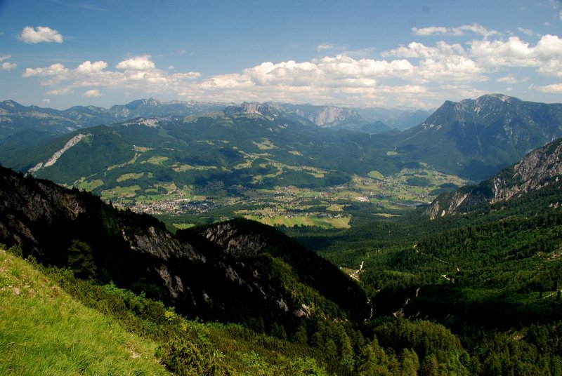
The trail follows the Soleweg path in the direction of Bad Goisern. After a few metres, the path comes to a salt house (Solestube) and turns right to ascend through the forest. The trail continues to ascend above the vertical cliffs of the Jochwand and then descends to a viewing platform with amazing views of Lake Hallstatt.
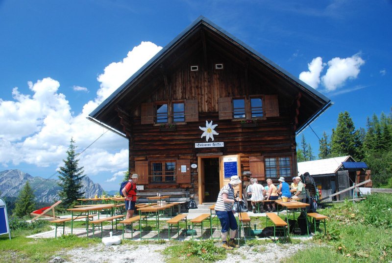
The trail continues right along a road to the houses of Obermuth and then heads left to a fork in the road. Keeping right along the access road, the trail quickly reaches the Hochmuth farmstead and then heads straight ahead uphill to the forest’s edge. The route begins the ascent of the mountain ridge. After an initially flat terrain, the trail starts to climb more steeply upward to the Pramesbergerrast peak (approx. 1330 metres, shelter available). The trail continues to moderately ascend along a beautiful path in a sparse forest eventually reaching the first huts of the Schartenalm alpine meadow. It then continues to the left over flat mountain meadows to the Goiserer Hütte alpine hut, which provides spectacular vistas.
Note for hikers
Salzkammergut Soleweg
Hallstatt - Steeg section closed
Steeg - Ebensee open
Dear hiking enthusiasts and nature lovers, the "Salzkammergut Soleweg" between Hallstatt and Ebensee will continue to be closed on a temporary basis. This means in detail: The path from the Salzberg in Hallstatt to the Bad Goiser district of "Steeg" is currently closed. The duration of the ban is not foreseeable. Please do not climb over the barrier. Stepping on the path is life-threatening due to rockfall!
Steeh - Ebensee open
Good news for hikers: The path from the Goisr district of "Steeg" to Bad Isch and on to the Traunsee to Ebensee is freely walkable.
Alternative Routen
If you want to hike from Hallstatt to Bad Ischl, we can recommend the "East Bank Hiking Trail" ("Ostuferwanderweg"). Take the ferry to the train station in Hallstatt, then continue on foot on the trail in the direction of the Bad Goiser district "Untersee" and from there in the direction of "Steeh". From here you will reach the "Soleweg" - The walking time for this section is about 3 hours.
We hope you enjoy hiking in the Salzkammergut
Your Editorial Team
Many prominent figures have explored this region: nobles like Archduke Johann and Empress Elisabeth, scientists such as Friedrich Simony, poets and authors like Nikolaus Lenau, painters like Ferdinand Georg Waldmüller, musicians and composers such as Johannes Brahms. Did they ever think that hiking in the Salzkammergut might have no end? That they could tramp from one lake to the next and then onward to yet another? Day by day along the shores of crystal-clear waters? Week-long excursions through quiet valley forests, over sunny alpine meadows and up mountains fuelled by the anticipation of the next destination? Further information…
Tips: Hiking in spring
The days in the Salzkammergut are getting longer. The temperatures are finally getting warmer, more and more hikers are heading to the mountains. But be careful: Especially in spring, there are a few things to consider: There is often still a lot of snow on the mountains, so be careful when crossing snowfields. After winter, you are usually still a bit "rusty", so warm up accordingly in advance and plan your tour carefully. Let your host know the planned route. This can lead to quick help in an emergency. But there's more to consider:
Safety Tips for Hikers
Admittedly, the landscape of the UNESCO World Heritage region of Hallstatt Dachstein Salzkammergut is the absolute pinnacle for hiking fans, mountain enthusiasts and nature lovers—unforgettable tours to incredibly beautiful mountain lodges and meadows, panorama views as far as the eye can see and cherished moments that will last a lifetime! However, you should remember that while hiking you might find yourself in high-alpine terrain. We’ve put together some resources to assist you: how to best prepare for your tour, recommended items for your backpack and steps to take in an emergency situation. Remember to always play it safe and enjoy your hiking adventure in the Salzkammergut!
Warning: Closed trails
Better to know before you go
Hiking trails in the Salzkammergut can be closed for various reasons. To help you prepare for your hike, we have set up a page with current road closures in the region. This will help you get to your destination without any detours or stress. Click here to visit the page...
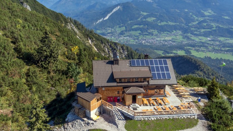
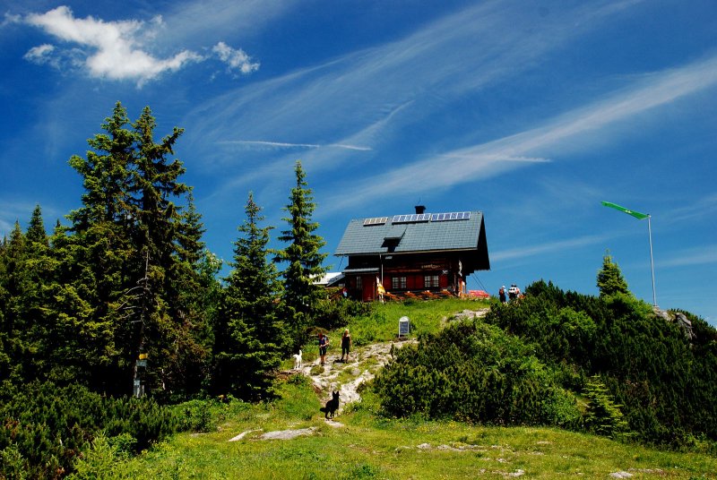
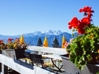
The katrin alpine cabin in Bad Isch
The cabin is located a few steps below the sum-mit station and looks back on a long tradition. It is easily accessible via a short descent and offers both, hikers in summer and ski touring lovers in winter, a cozy resting place to stay.

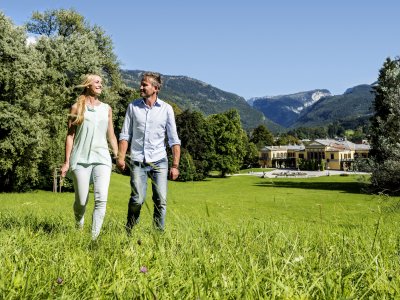
The Emperor City of Bad Ischl
Bad Ischl offers not only a great diversity of spa facilities but there is also the Katrin railway, which takes you to numerous hiking paths in the picturesque Salzkammergut area.
The Katrin mountain Inn
Der Katrin Berggasthof befindet sich bei der Seilbahn-Bergstation auf rund 1.400 Metern Seehöhe. Was unsere Küche „hinter den Kulissen“ kreiert, überzeugt durch erstklassige Qualität und vielseitigen Geschmack aus der Region.
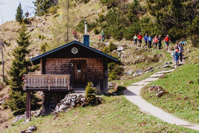
Goisererhütte / Goiserer hut
Bad Goisern on Lake Hallstatt | Goisererhütte: Here you will find tranquillity to dream, reflect and cuddle - time for partners, children or good friends in the middle of unspoiled nature, with the Goisern valley at your feet.

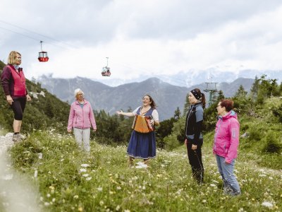
Five Lakes Via Ferrata on the Katrin near Bad Ischl
See five Salzkammergut lakes - only the "intermediate" via ferrata on Bad Ischl's Katrin excursion mountain can offer this. The tour covers about 150 metres in altitude and takes about two hours. The ascent is by cable car.

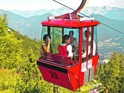
The ”Katrin Cable Car” in Bad Ischl
Enjoy a charming 15-minute drive to more than 1, 400 m above sea-level with spectacular views. Starting point for the magic 7-Lakes-View Hike or the impressive 3-Summits-Tour across the mountains.
Events
Yodelling Course in Bad Ischl 2024
Wed, May. 22, 2024 10:00 — 11:30 Katrin cable car valley station, Bad Ischl
Bad Ischl Katrin Mountain Run 2024
Sun, Jun. 9, 2024 09:00 Katrin cable car valley station, Bad Ischl
